AI CERTS
5 months ago
Huawei Pilots Conservation Computer Vision for Chinese Dolphins
This article dissects the pilot, reviews metrics, and examines emerging implications for global wildlife monitoring. Along the way, we assess benefits, challenges, and future opportunities for Conservation computer vision applications. Moreover, professional readers will find certification resources to deepen technical competence in environmental AI practice. Huawei’s partnership with China Mobile and the Third Institute of Oceanography also illustrates productive research collaboration frameworks. Therefore, lessons from Xiamen Bay may inform policymakers and technologists shaping future marine conservation initiatives.
Pilot Overview And Context
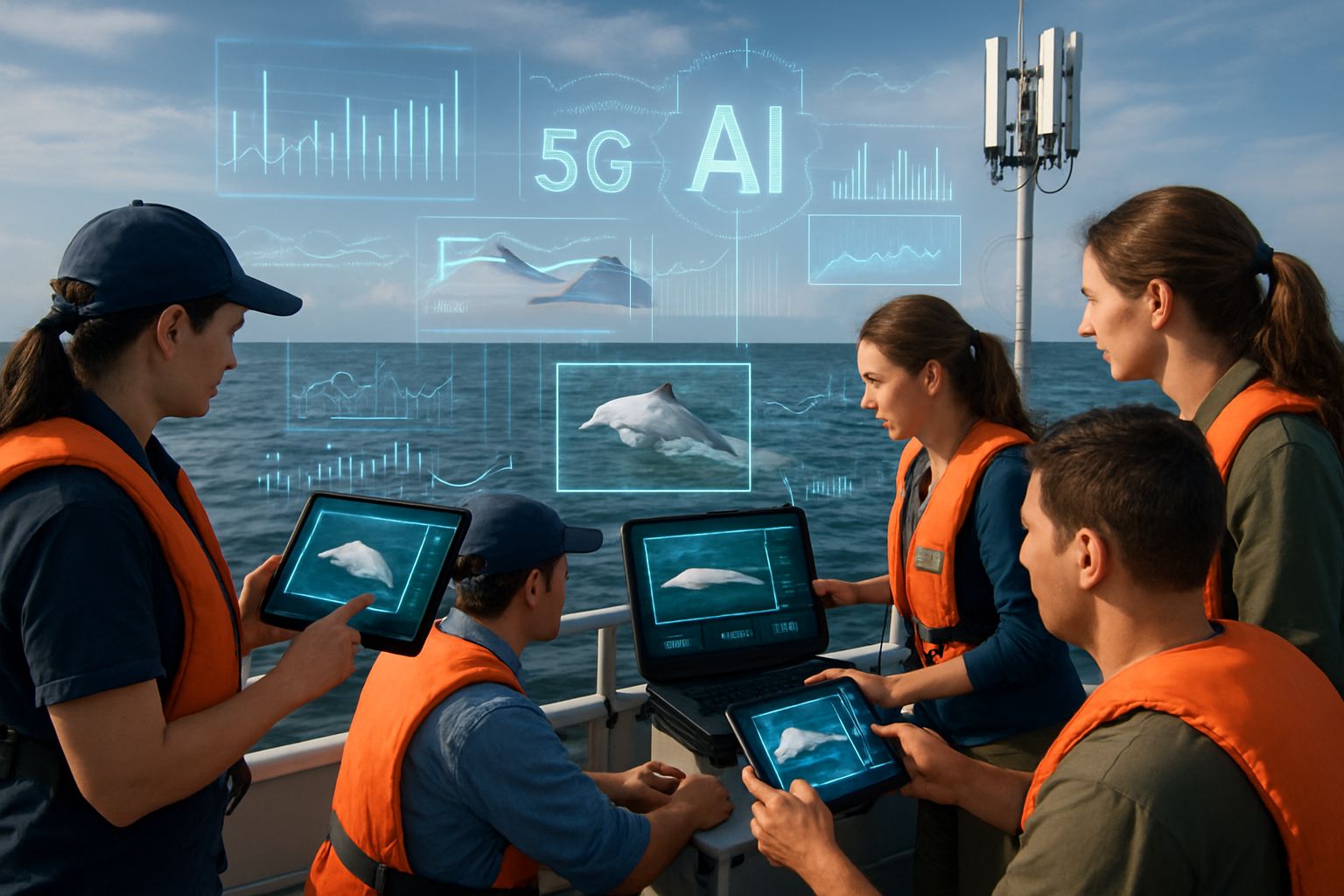
Huawei’s TECH4ALL team spent three months testing the system across 330 square kilometres of Xiamen Bay. Meanwhile, ten 5G-A base stations linked shore analysts with edge cameras positioned on strategic headlands. The Indo-Pacific humpback dolphin, locally called Chinese white dolphin, holds China’s highest wildlife protection status. Sightings have fallen as shipping traffic, dredging, and noise reduce critical coastal habitat.
Consequently, authorities seek technology that monitors animals and deters risky vessel behaviour in real time. Conservation computer vision meets that need by recognising unique dorsal-fin markings, much like human facial ID. Additionally, radar, Automatic Identification System, and satellite inputs give complementary perspectives on boat positions. During the initial phase, the AI processed 2,820 images and identified 13 individual dolphins.
Moreover, enforcement teams investigated twelve vessels that breached the reserve’s speed or boundary rules. These background details set the stage for deeper technical examination. However, fresh questions still surface.
Technical Architecture Explained Simply
At the heart lies a dorsal-fin recognition model trained on annotated photographs from earlier boat surveys. Furthermore, edge cameras perform initial cropping and enhancement before forwarding frames to on-premise GPUs. GPUs run inference, assigning probability scores that rank catalogue matches for each new fin image. Consequently, shore operators review top suggestions, approve identifications, and enrich individual life-history records.
A second pipeline fuses radar returns, AIS transponders, and visual feeds to deliver anomaly detection alerts. Therefore, if a vessel speeds near dolphins, a message appears on dashboards within seconds. Latency remains low because 5G-A backhaul avoids cloud detours and keeps processing near the coastline. Moreover, environmental AI heuristics adjust camera exposure and angle when glare or rain threaten image quality.
The architecture mirrors best practices from open platforms like Flukebook while tuning parameters for local water colour. Nevertheless, Huawei has not yet released code, training splits, or confusion matrices for community review. Independent scientists therefore remain cautious about reported >90% accuracy figures. The technical design looks promising, yet transparent documentation will strengthen trust during future research collaboration. Ultimately, Conservation computer vision underpins every workflow block within the architecture.
Key Performance Metrics Shared
Huawei published several headline numbers to demonstrate early traction. Additionally, partners claim the system already influences officer decisions on the water.
- Images and videos processed: 2,820
- Individuals identified: 13
- Identification accuracy: >90%
- Behaviour classification accuracy: 85%
- Enforcement response speed: +65%
- Data-labeling efficiency: 4×
Therefore, Conservation computer vision delivers measurable, albeit early, conservation performance indicators. Moreover, the company reports a 65% faster enforcement dispatch after anomaly detection alerts. These figures illustrate operational promise. However, sample size limitations invite cautious interpretation. Regular wildlife monitoring audits will verify whether identification rates remain stable. Broader validation will test whether metrics hold across seasons and varied sea states. We now examine concrete benefits for onsite teams.
Benefits For Field Teams
Faster identification streamlines wildlife monitoring workflows, saving researchers hours once lost to manual cataloguing. Furthermore, edge cameras transmit compressed frames, reducing energy demands on remote solar power supplies. Field officers receive real-time notifications when anomaly detection flags speeding boats near known breeding pairs. Consequently, patrol craft can intercept violators before collisions or noise disturbances occur.
Data-labeling efficiency improved fourfold, freeing scientists to design broader environmental AI experiments. Moreover, the dorsal-fin database supports longitudinal studies of survival, reproduction, and movement. Conservation computer vision also offers educational outreach, showing tourists individual stories that humanize protection efforts. In contrast, traditional boat surveys required larger crews and higher fuel budgets.
Additionally, research collaboration thrives when shared dashboards let multiple institutions access standardized data sheets. These advantages motivate continued investment; however, unresolved gaps still challenge project credibility. Let us explore those outstanding challenges.
Challenges And Validation Gaps
Independent audits have not verified Huawei’s >90% identification accuracy claim. Moreover, the current dataset covers only 2,820 images, a modest sample for machine learning models. Small datasets often inflate performance due to limited environmental variation. Consequently, seasonal glare, turbidity, and calf growth may degrade recognition in future deployments.
Robust Conservation computer vision depends on balanced datasets reflecting varied lighting and sea states. Governance questions also persist because ownership of image archives and vessel tracks is unclear. Nevertheless, project leaders promise forthcoming white papers that detail algorithms and data-sharing policies. Environmental AI specialists urge public release of confusion matrices and cross-validation scripts.
Additionally, anomaly detection alerts may generate false positives, potentially wasting enforcement fuel and time. Coastal cameras must also withstand typhoons, salt corrosion, and vandalism over longer operational periods. These challenges highlight critical gaps. However, developers can address many through open science and adaptive maintenance. Continued research collaboration will be essential for rigorous validation and policy integration. Broader industry trends offer useful parallels worth exploring.
Broader Conservation Technology Trends
Around the globe, Conservation computer vision now aids species from snow leopards to Hawksbill turtles. Similarly, edge cameras integrate with acoustic sensors to monitor African savannah elephants. Moreover, anomaly detection models flag poaching hotspots by analysing vehicle trajectories in protected parks. Wildlife monitoring platforms increasingly run on solar-powered microservers, reducing operational emissions.
Consequently, environmental AI adoption grows as hardware costs drop and open source communities mature. Many projects emulate Huawei’s model of public-private research collaboration for faster pilot execution. In contrast, some conservationists warn against technology hype that distracts from habitat regulation and funding needs. Nevertheless, when properly validated, Conservation computer vision can scale field data collection beyond human limitations.
Additionally, cross-border data standards will ease integration of regional dolphin catalogues in future. These trends contextualise Huawei’s initiative and foreshadow industry directions. Therefore, practitioners should watch developments closely.
Next Steps And Takeaways
Independent peer review remains the immediate priority for Huawei and partners. Furthermore, sharing anonymised image sets will let academic groups benchmark algorithms objectively. Conservation computer vision deployments also need long-term maintenance budgets and cyber-security safeguards. Consequently, funding proposals should incorporate hardware replacement cycles and staff training plans.
Policymakers must clarify data ownership, retention periods, and citizen privacy when vessel tracks are archived. Additionally, expanding edge cameras to adjacent bays could test scalability across ecological gradients. Moreover, continuous research collaboration will align technical updates with evolving conservation objectives. Professionals can enhance their expertise with the AI Data Robotics™ certification.
These actions will help translate pilot promise into durable conservation impact across global coastlines.


